

Top 5 Tools to Draw a Radius on a Map for Business Planning
- Sep 3, 2025
- 5 min read
Updated: Sep 9, 2025
Written by Marco A. Benavides, Marketing Consultant
Marco Benavides leads Trinity Marketing Solutions, bringing over 10 years of digital marketing expertise to help businesses boost online visibility and growth. He's passionate about connecting business owners with proven marketing strategies that deliver real ROI.

When it comes to business expansion, choosing the right location can make all the difference. Whether you’re opening a new store, evaluating delivery zones, or analyzing customer reach, geography plays a vital role. This is where geo-intelligence comes in, a powerful way to turn location data into smart, actionable strategies.
Geo-intelligence refers to the practice of using geographic information, data visualization, and mapping technology to support decision-making. By drawing simple tools like radius maps, businesses can understand how far their influence extends, who their potential customers are, and whether a location is truly worth the investment.
What is geo-intelligence and why it matters?
Geo-intelligence refers to the practice of using geographic data, maps, and analytics to support strategic decision-making. It combines traditional mapping with advanced data visualization, helping businesses answer critical questions such as:
Where should we open our next store?
How far are customers willing to travel to reach us?
Which neighborhoods have the right demographics for our services?
How can we optimize delivery routes to save time and costs?
Tools like the Smappen radius map tool make it easier to turn these questions into actionable insights by showing realistic catchment areas and customer reach. Without geo-intelligence, businesses risk making costly mistakes, opening a store in an area with low demand, misjudging travel distances, or missing out on more profitable neighborhoods. With it, they can move from guesswork to evidence-based decisions.
Key factors to consider in location-based decisions
Before diving into the tools, let’s quickly look at the factors businesses should analyze when working with radius maps and geo-data:
Demographics: Who lives within the radius? Age, income, household size, and spending habits matter.
Travel time vs. distance: A 5-mile radius is not the same as a 15-minute drive. Traffic patterns, road networks, and public transport influence accessibility.
Competition mapping: Where are competitors located? Sometimes being near them helps, while other times it’s better to avoid saturation.
Infrastructure & accessibility: Parking, public transport, highways, and foot traffic all impact site attractiveness.
Market potential: Beyond just the number of people, how many within that radius are your target customers?
With these in mind, let’s look at the tools that help businesses put theory into practice.
Top 5 tools to draw a radius on a map for business planning
1. Smappen: The complete geo-intelligence platform
Best for: Businesses that need advanced, data-driven geographic insights.
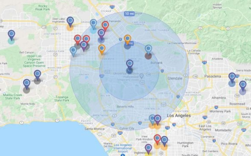
Smappen stands out because it’s more than just a tool to draw a circle on a map. It’s a full geo-intelligence platform designed specifically for businesses. Unlike simple distance-based radii, Smappen lets you create isochrones, areas defined by travel time (e.g., “everything within 15 minutes by car”). This is a game-changer because customers don’t travel in straight lines; they use real roads, and Smappen accounts for that.
Key features:
Travel-time catchment areas (isochrones).
Demographic analysis to evaluate age groups, income levels, and population density.
Market potential evaluation to predict demand.
Intuitive visualizations that make insights clear even for non-technical users.
2. Google maps: The familiar everyday tool
Best for: Quick, simple checks for distance and accessibility.
Google Maps isn’t built specifically for geo-intelligence, but its accessibility makes it a starting point for many businesses. By using free third-party add-ons or drawing tools, users can create a radius around a point of interest.
Strengths:
Easy to use, globally available, and free.
Ideal for small businesses that need basic checks.
Provides directions, traffic patterns, and public transport info.
Limitations:
No built-in demographic or market data.
Radius drawing requires extra steps or third-party support.
3. Mapdevelopers: Quick and beginner-friendly
Best for: Small businesses or individuals needing instant radius maps.
Mapdevelopers.com is a simple, no-frills tool. Enter an address, set your radius, and instantly see the circle drawn on a map. It doesn’t provide advanced analytics, but it’s fast and accessible.
Strengths:
Free and simple to use.
Great for visualizing delivery zones or service coverage.
Limitations:
Lacks demographic insights.
Only works with distance, not travel time.
4. Maptive: Custom business mapping
Best for: Companies needing visualization plus advanced data integration.
Maptive takes mapping to the next level by allowing businesses to upload their own datasets. From there, they can draw radii, analyze clusters, and even create territories.
Strengths:
Upload spreadsheets and overlay them on maps.
Create multiple radii to compare coverage.
Useful for territory planning and route optimization.
5. EasyMapMaker: From spreadsheets to radius maps
Best for: Businesses that work heavily with spreadsheets but want visual clarity.
EasyMapMaker allows users to upload Excel or CSV files containing addresses, then instantly plot them on a map. From there, you can draw radii around key points and start analyzing patterns.
Strengths:
Perfect for non-technical teams who use spreadsheets daily.
Can plot thousands of points at once.
Radius tools help identify clusters and gaps.

Best practices for using radius tools in business planning
Radius tools are only as powerful as the way you use them. Here are some best practices:
Think travel time, not just distance. Customers judge accessibility in minutes, not miles.
Combine radius data with demographics. Knowing “how many” people live in a zone is less valuable than knowing “who” they are.
Layer multiple insights. Combine customer data, competitor locations, and infrastructure for a holistic view.
Use radius maps as a starting point. They’re a foundation, but deeper geo-intelligence is what drives real strategic growth.
The future of geo-intelligence in business planning
As technology continues to advance, geo-intelligence is becoming more powerful, more accessible, and more essential for businesses of all sizes. What used to be a specialized field requiring GIS (Geographic Information Systems) expertise is now available through intuitive platforms that anyone can use. This shift means that even small businesses can harness the kind of insights that were once reserved for multinational corporations.
One of the biggest trends shaping the future of geo-intelligence is the integration of real-time data. Instead of working with static maps, businesses can now analyze live traffic flows, customer movement patterns, and even seasonal demand changes. For example, a retail chain could use geo-intelligence to identify peak shopping times in specific neighborhoods, while a food delivery service could optimize routes based on live congestion data.
Geo-intelligence for small vs. large businesses
One of the biggest advantages of modern geo-intelligence tools is that they scale to fit businesses of all sizes. A small local bakery might only need a simple radius to understand its delivery coverage or foot traffic potential, while a large retail chain could use the same tools to evaluate expansion opportunities across multiple cities. The flexibility of platforms like Smappen ensures that whether you are a startup experimenting with your first location or an established company planning national growth, the same insights can be tailored to match your scale and objectives.
Conclusion
Drawing a radius on a map may seem simple, but it’s often the first step in unlocking powerful insights. From understanding customer reach to optimizing logistics and choosing the perfect site, radius tools give businesses a visual way to transform geography into opportunity.
For businesses seeking more than just a circle, platforms like Smappen elevate mapping into true geo-intelligence. By combining demographic analysis, travel-time zones, and data visualization, Smappen helps companies make smarter, evidence-based decisions.
Read more from Marco A. Benavides
Marco A. Benavides, Marketing Consultant
Marco Benavides is a digital marketing strategist and founder of Trinity Marketing Solutions, where he has spent over a decade helping businesses transform their online presence and achieve sustainable growth. His expertise spans lead generation, SEO optimization, content marketing, and comprehensive digital strategies that deliver measurable ROI. Marco combines data-driven marketing techniques with faith-based business principles, creating authentic connections between brands and their audiences. Through Trinity Marketing Solutions, he has guided countless business owners in navigating the digital landscape and building lasting success.


